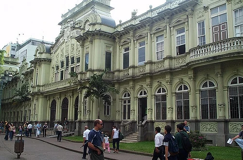
Central Post Office, downtown San Jose
And, here's where it starts to get a bit complicated. So you've arrived in Costa Rica, you know where you're supposed to go, you look it up on the internet... and you get something that looks absolutely nothing like a street address.
- Heredia, 50 oeste de la entrada principal de la UNA
- 1 km al oeste y 500 norte de Zona Industrial Zeta, complejo de bodegas a mano derecha.
De la antigua pulpería La Luz, Los Yoses, 75 norte, casa de 2 pisos con verjas negras.
Welcome to your first culture shock: street addresses.
Where the streets have no name[]
Most streets in Costa Rica have no name, and no number. Or they might have a name and number, but there was never any sign saying it. So, people completely ignore street names and numbers. Costa Rica is the real world place, where the streets have no name.
How does something like that happen? How is something like that allowed to happen? Most people will tell you it's a mystery. A combination of banana-republic history, lack of government funding for signs, and excessive uncontrolled urban sprawl. Street names and numbers in the traditional sense the entire world uses, do not exist here. Just accept it and go on.
In fact, if you try to use street names and numbers, you're bound to confuse anyone you might talk to, and probably even get them lost. So don't.
Ok, just for the record, some streets have numbers[]
If you go downtown in some of the larger cities (San Jose mainly), you'll find the inner core of streets are numbered, and on some corners you can find signs telling you where you're at. Not all of them, but enough to give you an idea.
Numbering of streets follows some standard rules:
- Roads are divided into streets and avenues, much like anywhere else. Streets run north to south, avenues run east to west.
- Numbering starts at 0 or "central". Most cities will have a central street and central avenue.
- Even streets are to the west of central, odd to the east. That is, to they east they're numbered 1,3,5,7,etc. and to the west 2,4,6,8, etc.
- Even avenues are to the south of central, odd to the north.
Simple enough, the only detail you have to look out for is the odd and even numbering. If you're looking for 3rd avenue, you have to move north, past 1st. You'll never find it located after 2nd avenue.
If you're on 3rd avenue, you know you're to the north of central. If you're on 2nd street, you're to the west of central.
Buildings, unfortunately aren't numbered. And where they are, they follow no real standard. Most addresses where there's numbered streets are given in the form "Calle X, Avenidas N y M", or "CX, Av. N-M". This means you go to X street, and look between avenues N and M. For example "C5, Av. 3-5" means the building is located on 5th street, between avenues 3 and 5.
And for the rest of the country[]
Here's where it gets interesting. Addresses in the rest of the country work by landmarks. People choose highly visible or well known landmarks, and give you distance vectors that follow the roads. Don't be alarmed by "distance vector", it's just a neat way of saying they give you a direction and a distance to follow.
It's a lot like asking for directions in rural towns, where they tell you "follow the dirt road until you get to the gas station, there you turn left and keep going until you find main street".
You'll usually get your landmark, and a series of distances and directions. And you follow them. Distances are given in meters, 1 city block is assumed to be 100 meters. So if they say 300 north, it means go 3 blocks north. If they tell you 300 N, 500E, go 3 blocks north and 5 blocks east.
Odd distances like 150 meters mean the place you're looking for is either a block and a half away, or there's an odd city block that measures less than usual. Sometimes it happens, and they'll tell you "150 meters" so you don't get confused by the shorter block.
When you get a mid-point direction, for example SE or NE, that's usually because the street is on a diagonal. Just follow the road in that general direction and don't worry about it.
You'll probably also get a description of the building you're looking for, to help you pinpoint it. They'll tell you how many floors, what color the walls are, or what color the bars on the windows are (really!).
So, how can you tell north-south-east-west?
Most people in the metro area guide themselves by stuff on the horizon, or by knowing in what general direction different cities are. So for example if you know what direction Cartago is in, you know east. If you know what direction Heredia is in, you know north. The opposite is also true: if you can see the downtown area buildings and you know where they're at, you have your reference.
Others just go the easy route and use a compass, or ask for directions.
In rural areas, you're going to have a bit more trouble with directions. In those cases you're better off using a GPS. Use Google Earth to search for your destination, copy the GPS coordinates, and load them into your unit.
LIfe is a highway[]
National highways and primary roads are clearly labeled. They're about the only roads that have been permanently marked, and many people know them by numbers, at least the most used ones:
- Route 1-2: Interamerican Highway. Runs the entire country from north to south.
- Route 21: Nicoya Penninsula circuit. Jicaral - Liberia.
- Route 27: San Jose - Caldera (Puntarenas)
- Route 32: San Jose - Limon
- Route 34: Pacific Coast, south. Puntarenas - Osa